
Photo from punch
Adebayo Folorunsho-Francis, Ikenna Obianeri, Umar Sani, Samuel Ese, Animasahun Salman, Isah Ojo, Collins Agwam, Matthew Ochei, Chima Azubuike, Bankole Taiwo and Tunde Oyekola
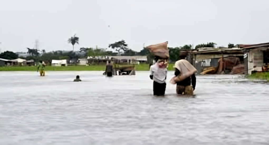
Before the rainy season, the states initiated efforts to curtail the flooding that will affect at least 1,249 communities in 176 local councils in 30 states and the Federal Capital Territory of Abuja.
The measures involved are public enlightenment campaigns, desilting waterways, and the resettlement of people living on riverbanks and floodplains.
The federal government, on Thursday, said the states will experience severe flooding from April to November.
This was disclosed by the Minister of Water Resources and Sanitation, Prof. Joseph Utsev, during the release of the 2025 Annual Flood Outlook by the Nigeria Hydrological Services Agency in Abuja.
Utsav listed the flood-risk states as Abia, Adamawa, Akwa Ibom, Anambra, Bauchi, Bayelsa, Benue, Borno, Cross River, Delta, Ebonyi, Edo, Gombe, Imo, and Jigawa.
The rest are Kebbi, Kogi, Kwara, Lagos, Nasarawa, Niger, Ogun, Ondo, Osun, Oyo, Rivers, Sokoto, Taraba, Yobe, Zamfara, and the FCT.
The minister bemoaned that flooding is still among the most destructive natural disasters in Nigeria and that climate change is speeding up its frequency and intensity.
He also forecast that the coastal and riverine states like Bayelsa, Cross River, Delta, Lagos, Ogun, Rivers, and Ondo would be flooded by the rising sea level and tidal surge, and this would affect fishing, wildlife habitats, and riverine navigation.
The 2025 Annual Flood Outlook states that 1,249 communities in 176 local government areas in 30 states and the FCT are classified as high flood risk areas, and 2,187 communities in 293 LGAs in 36 states of the federation and the FCT are classified as moderate flood risk area"s.
"Flash and urban flooding are predicted in major urban areas across the country because of heavy rains, lack of concern regarding the upkeep of water infrastructure, such as drainage and waterways, and no flood resilience systems."
But whereas the flood, as distinct from other disasters, can be controlled with anticipation and provision of suitable infrastructure, rather than universal predictions, now predictions are done for communities, and this improves actionable communication and preparation at the grassroots level," he said.
Earlier in his speech, Ministry of Water Resources and Sanitation Permanent Secretary Richard Pheelangwah challenged stakeholders to take early response.
He added, "This approach is not only about numbers; it's about saving livelihoods and lives."
The NIHSA Director General and Chief Executive Officer, Umar Mohammed, stated that the forecasting of floods this year breaks the trend of simply mapping LGAs and instead marks particular communities as vulnerable.
Mohammed further added that the new approach taken by the AFO is the result of ongoing feedback, technological advancement, and extensive inter-agency collaboration.
We are translating flood data into timely decisions and practical resilience construction. Our mandate has now been broadened to evaluate sectoral impacts on health, education, agriculture, and infrastructure, and to provide policymakers and disaster risk managers with stronger tools," he added.
Acting on the prediction, the Anambra State Emergency Management Agency confirmed that it has warned its citizens who live in flood-affected local councils and communities to prepare themselves because their areas would be flooded since April.
Anambra State Emergency Management Agency's Deputy Publicity Secretary, Uche Okalawan, revealed that clearing obstructed drainages and realigning obstruction-causing structures inhibiting free flow of water have already started, courtesy of the state government.
Okalawan identified 10 local government councils among the 21 LGs in the state as flood-prone areas.
They are Ogbaru, Ayamelum, Anambra East, Anambra West, Onitsha South, Onitsha North, Awka North, Idemili South, Ekwusigo, and Ihiala.
He further stated, "The state government has commenced de-silting water channels and clearing the blocked drainages. Residents in these communities have been warned and alerted of the looming flooding."
During flooding, the state governor, Prof. Chukwuma Soludo, established internally displaced persons camps that remain intact, and women, the elderly, and children will be resettled to the camps forthwith.
"The state government also implored them to reach out to their local government emergency management committee."
The Kwara State government elaborated that it is also widening the path of the river where the state experiences flooding, urging citizens to move from flood-prone areas and warning residents against dumping refuse into water bodies.
The Commissioner for Environment in the state, Hajia Nafisat Buge, elucidated that the government has also been working towards avert flooding in the state.
Buge disclosed that the state started expanding Asa River, which has been found to be among the major causes of flooding in Ilorin and local governments.
"The state government of Mallam AbdulRaman AbdulRazaq instructed that the watercourse of the Asa River and other watercourses be dredged for expansion to pave the way for the free flow of water during the rainy season."
We have also taken proactive measures in areas listed by the Nigerian Meteorological Agency." The government also insisted that inhabitants along the river in Ilorin metropolis, Patigi, Edu, Moro and other local governments affected by flooding should be relocated and that it ordered constructions of dykes or levees, a dyke or a bank to a riverbank or seashore to block floodwaters flowing through while inhabitants around the river were directed to move away from there," she explained.
She stressed the need for dredging, further buffer construction and afforestation to counter flooding in towns.